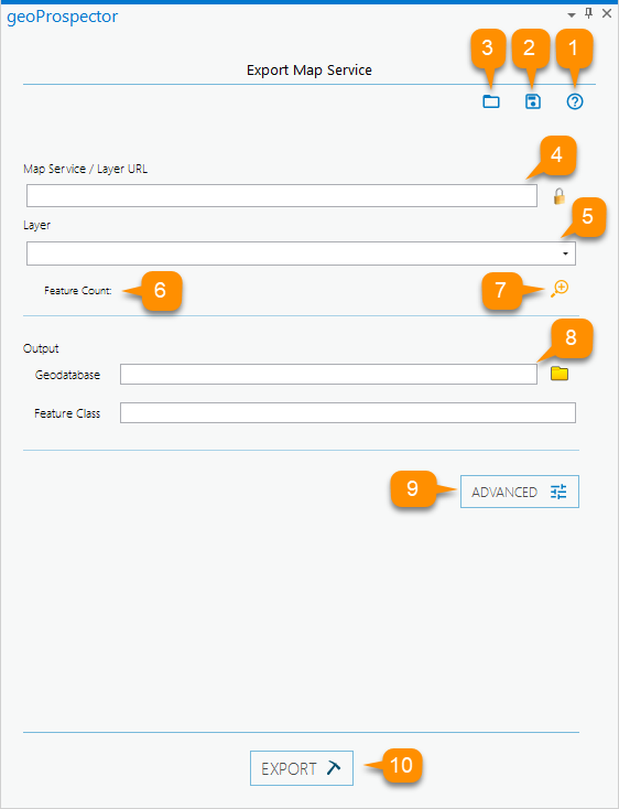
1. geoProspector Help button
Opens a dialog providing links to geoProspector documentation and support options.
2. Save Configuration File button
Save Configuration exports your current settings to use again at a later date without having to re-enter all the service settings.
3. Load Configuration File button
Load Configuration imports previously saved geoProspector configurations settings to download data previously downloaded quickly.
4. Map Service / Layer URL text field
Type or paste in the URL of a Map Service or layer you want to download into the text field. If the service is secured and you have credentials, select the lock icon, and enter a username and password.
5. Layer Selector combo box
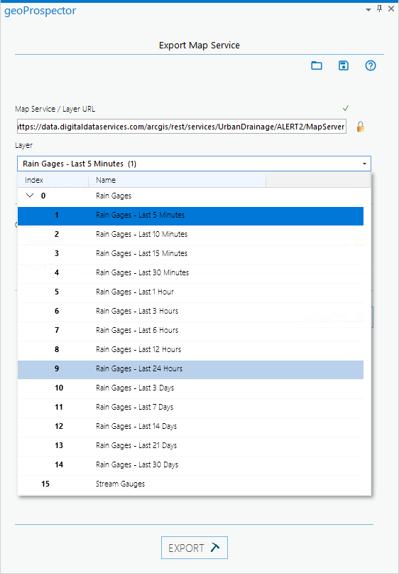
The Layer Selector will display the layer name. If you enter a Map Service, it will display the first layer. If a Map Service has multiple layers, you can click on the Layer Selector to switch to a different layer. For more information, see About the Layer Selector below.
6. Feature Count
The Feature Count displays the number of features in the selected layer. For more information, see About Feature County below.
7. Zoom to Layer button
Clicking the Zoom to Layer icon allows you to zoom to the full extent of the selected layer in your ArcGIS Pro map.
8. Output Geodatabase and Feature class fields
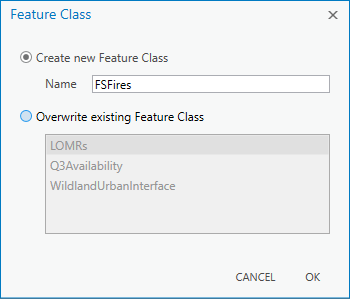
To define the output File Geodatabase, click the folder icon and use the File Dialog to either select or create a target File Geodatabase. geoProspector will prompt you to either create a new Feature Class or overwrite an existing Feature Class.
9. Advanced Settings
The Advanced button opens geoProspector’s Advanced Settings. For more information, please see the geoProspector Advanced Settings section of this documentation.
9. Export button
After defining the Map Service layer, target Geodatabase and Feature Class, click the Export button to begin the feature export. During the export progress, geoProspector provides detailed feedback in the Export Progress pane.
About the Layer Selector
When using the Layer Selector with a Map Service, geoProspector displays all the layers within the Map Service, including grouped layers. Simply select the layer you want to download from the selector.
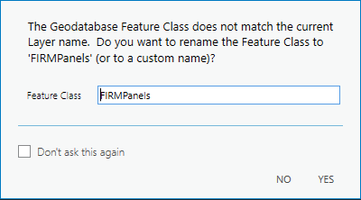
NOTE: If you have already defined an output Feature Class and select a different layer, geoProspector will prompt you, if the layer name does not match the Feature Class name, before exporting to ensure you do not write data into the wrong Feature Class.
About the Feature Count
Every time you change a Layer or update the Advanced Settings, the Feature Count will update displaying the number of features you will be downloading.
If you Feature exceeds 100,000 records, geoProspector will display a warning icon. geoProspector has a maximum threshold of 250,000 features. At this number, you should look at alternative ways of acquiring this data.


